
Om Parvat · Adi Kailash
Om Parvat — Location, Story, Temperature & How to Reach
ByHimanshu, Founder· Pithoragarh ·
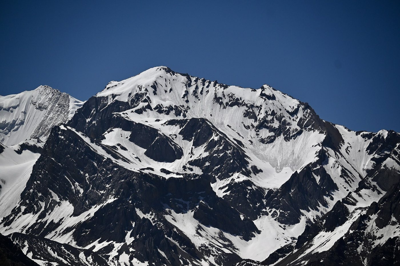
Somewhere on the drive from Gunji, the escort stops the vehicle, points across the valley, and goes quiet. On the dark face of a 5,900-metre mountain, snow lies in channels of rock in a shape every Indian recognises instantly: ॐ. Not carved, not imagined — settled there naturally, and renewed by every snowfall. That mountain is Om Parvat, and for many yatris its darshan is the single most affecting moment of the entire journey.
Where exactly is Om Parvat?
Om Parvat stands in the Vyas Valley of Pithoragarh district, Uttarakhand, near the point where India, Nepal, and Tibet meet. The viewing point is Nabhidhang (~4,340 m), a windswept halt on the historic Kailash Mansarovar route as it climbs toward the Lipulekh pass. There is no trek: the road — 4x4 territory beyond Dharchula — goes to the darshan point itself.
| District | Pithoragarh, Uttarakhand |
| Darshan point | Nabhidhang, ~4,340 m |
| The peak | ~5,900 m on the Indo–Nepal border ridge |
| Nearest town | Dharchula (last reliable network & ATMs) |
| Permit | Inner Line Permit (ILP) — mandatory |
| Season | May–June & September–October |
The story of the ॐ
Tradition holds the formation to be svayambhu — self-manifested — one of the places where the primordial sound took visible form. The Vyas Valley itself is named for the sage Vyasa, and the route to Nabhidhang passes Kalapani, honoured as a source of the Kali river. Pilgrims bound for Kailash Mansarovar historically took Om Parvat’s darshan as the blessing for the road ahead; today, paired with Adi Kailash, it forms a complete yatra inside India.
What makes the sight remarkable is its permanence. Snow patterns on other peaks come and go with the weather; Om Parvat’s channels hold the symbol in place season after season. The face is at its boldest after fresh snowfall on a clear morning — which is why itineraries reach Nabhidhang early in the day.
Om Parvat temperature, month by month
Approximate conditions at the Nabhidhang darshan point (~4,340 m), with nights given for Gunji (~3,200 m), where yatris actually sleep. Dharchula, the valley base at ~915 m, runs 15–20°C warmer than the top.
| Months | Day at Nabhidhang | Night at Gunji | What to expect |
|---|---|---|---|
| May | ~5–12°C | around or below 0°C | maximum snow — the ॐ at its boldest |
| June | ~8–15°C | ~0–5°C | warmest, most popular window |
| July–August | ~8–15°C | ~8–12°C | monsoon cloud often hides the face; roads landslide-prone |
| September | ~5–12°C | ~0–5°C | the clearest skies of the year |
| October | ~2–10°C | ~−2 to 2°C | crisp and quiet; last departures early–mid month |
| November–April | — | — | road closed under snow |
Ranges are drawn from our season batches on the route, cross-checked against meteorological model data for Nabhidhang and Gunji.
Two honest caveats. First, wind chill matters more than the thermometer above 4,000 m — a sunny 8°C at Nabhidhang feels like much less when the wind funnels up the valley, so carry proper layers even in June. Second, these are ranges, not promises; the mountain sets its own weather. The photos across this site are from one of our late-October batches — brilliant sunshine, deep blue sky, and everyone in down jackets. Our packing checklist covers exactly what to bring.
How to reach Om Parvat
The route is the classic Vyas Valley ladder:
- Kathgodam / Tanakpur — overnight trains from Delhi
- Pithoragarh → Dharchula (~915 m) — last town with reliable network
- Dharchula → Gunji (~3,200 m) — 4x4s, Inner Line Permit checks en route
- Gunji → Nabhidhang (~4,340 m) — darshan, usually paired the same trip with Adi Kailash at Jolingkong
Every visitor needs an Inner Line Permit — the process, documents, and timelines are in our permit guide, and we file it for all our travellers. Because the viewpoint sits above 4,300 m, the altitude deserves respect: our 7-day routes hold an acclimatisation day at Gunji, our quicker routes screen harder instead, and our fitness & altitude guide explains what the height asks of every itinerary.
Seeing it for yourself
Om Parvat is never visited alone — it pairs naturally with Adi Kailash on a single circuit, and that is how all four of our routes run, from a 4-day express ex-Dharchula to the door-to-door 8-day yatra ex-Delhi. Compare them on our Adi Kailash Yatra guide, or ask us anything on WhatsApp — the person answering has stood at Nabhidhang more times than they can count.
Want help planning this? Talk to us directly.
Chat on WhatsApp